
Boat How - Lake District Walk
Friday 16th June 2006
The intention of today's walk was to reach the summit of Scafell and descend via Slight Side, but as we arrived at the campsite an hour later than we had planned for we had to make the decision halfway up Scafell to turn back or risk returning in failing light. A quick check of the map meant that we returned via Boat How and the Boot Inn, which we couldn't pass without calling in for a well earned drink.
Start: Hollins Farm Campsite (NY 178 010)
Route: Hollins Farm Campsite - Eel Tarn - Burnmoor Tarn - Hard Rigg - Burnmoor Tarn - Boat How (89) - Brat's Moss - Boot Inn - Hollins Farm Campsite
Distance: 8.25 miles Ascent: 580 metres Time Taken: 5 hrs
Weather: High cloud but warm and bright.
Pub Visited: The Boot Inn, Boot Ale Drunk: Little Valley Brewery, Crag Vale

Looking back at Eel Tarn.
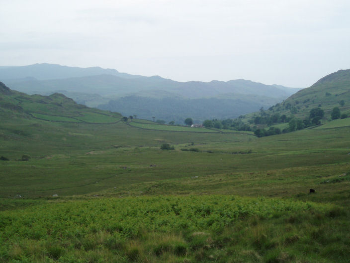
The view back down the valley with Gill Bank farm just visible.

Burnmoor Tarn, the bump on the hill to its left is the summit of Boat How

Eskdale Fell from the ascent to Scafell.

Yewbarrow with Wast Water to its left.

Illgill Head looks far less dramatic from this side, where there are no scree slopes.

Scafell at the time we estimated we might have made the summit.
When we decided to give up on the summit it was in cloud.

Looking down Mitterdale from the summit of Boat How. The hump sticking out of the trees on the right is Great Bank.

Boat How summit.

Scafell with Eskdale Fell in front, from Boat How.

Green Crag across Eskdale valley.

Harter Fell from the path down to Boot.
All pictures copyright © Peak Walker 2006-2023